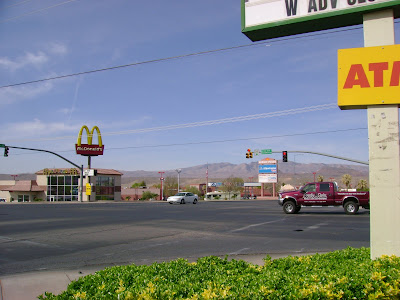
Day 2 Jan 13, leaving 9am sharp. Start and Finish point is Lins grocery store parking lot, 1930 W Sunset Blvd, StG. Ya got your choice of Lins, and across the road Albertsons and McDonalds for pre and post ride grub. Yummy!
This is a 5-7 hour ride w/ no water on route - and no filter options. It's a dry one so come carrying your goods. If ya'll want to have water midway organize a car to be at Bloomington...but yer on yer own for that one. Park at the end of Navajo drive. Navajo drive is 2-3 hours or about 20 miles in, before the Blakes climb and a good place to bail for those looking for a shorter day.
He he he, I give you a 20 mile warmup before the big climb...
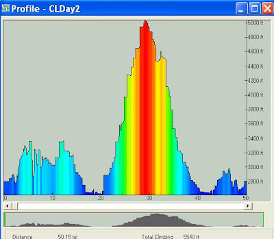
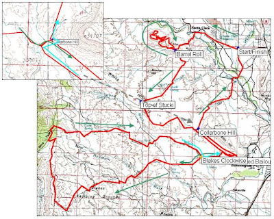
Here's the map overview - Barrel Roll singletrack, Stucki (wide singletrack), Blakes climb (big red blob on profile). Lots of shortcuts, bailouts, and extenstion options. Follow the arrows for the full route. You'll be riding further and climbing more than the gps file indicates. You can thank that 250 garmin point limit.
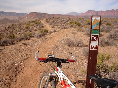
Barrel Roll. The sign says look at the view. The arrow/dot sign cracks me up!
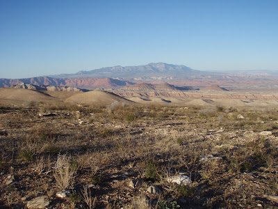
View from Blakes. Ya'll love Blakes - deceptive desert climbing at it's best. Ya gotta ride it to know what I'm talking about. A wee perspective, that lil' hill on the horizon is 8,000' taller than StG.
The attached zip file below has the .gpx and Garmin file for the day.