Smoky Mountain 'sploratory

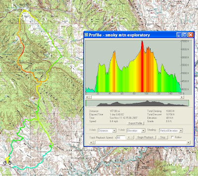
The Smoky Mountain road between Big Water and Escalante covers huge expanse of remote, lonely, beautiful country.  The road surface is actually quite good for the most part.  Water availability is not bad either.  It's been dry for a good long while yet we found plenty.  The area lends itself nicely to an ambitious 2 day or ambling 3 day bike trip - I highly recommend it so I'll post a few more details than normal for this one.

A lot of these pics ya gotta click for the big version...

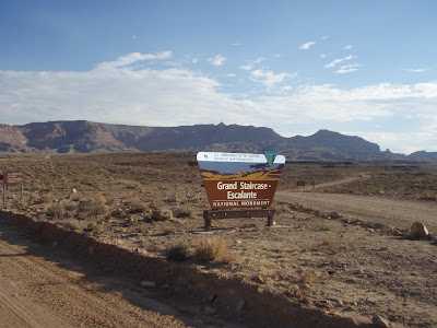
Near the start of the route (starting at Big Water) this sign looks so new and official.  Not to worry, the man was nowhere to be seen and every other sign was bullet riddled, old and illegible ;)

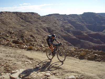
After a bit the climbing comes on in earnest taking you up to the southern end of the Kaiparowits plateau.  Initially steep, it rolls a lot through drainages and contours in other spots.

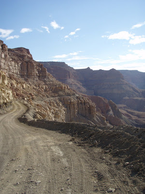
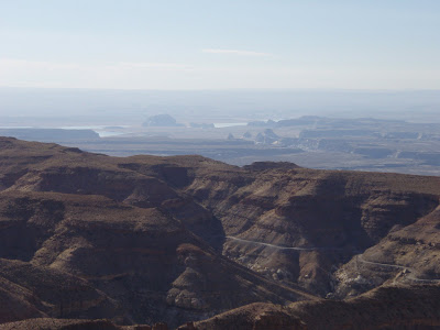
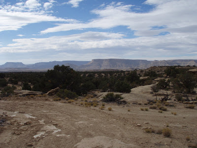
Lake Powell in the distance, Smoky Mountain road contouring below.

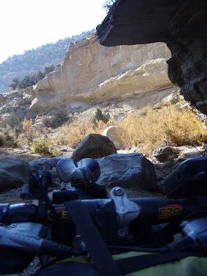
Ion working it up the final grunt to the plateau.

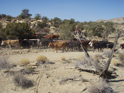
Other signs of life.  This was the first (but not last) time I would hear yee-haw! this trip.  Cowboys are grumpy.

We took a diversion.  At Collet Top we headed over the Left Hand Collet canyon to descend to Hole in the Rock road.  The Grand Staircase site said the road conditions were "unknown."  In the future I'll know unknown means non-existant.  The conditions were unknown cause this rockslide prevented vehicle traffic and the road was later abandoned. 

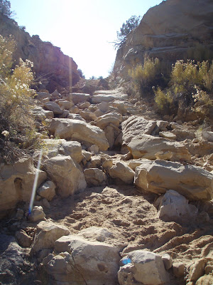
For the most part we traveled a stream/canyon bottom for 11 miles.  Most of it was rideable but very slow.  Sand, water, big rocks and boulders, a bit of slickrock - a real cornucopia of conditions.  Slow going, but it really put a smile on our face anyway.  It's not everyday you get to ride something like that.

A cruise on HitR road took us to Escalante.  It'd be easy to get lodging there and not take the overnight gear...

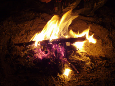
But you'd miss out on this.

You'd also miss out on the redneck locals.  For future reference don't ever camp in the open near towns on a Sat night.  Holy crap...repeated high powered rifle shots overhead scared me beyond belief.  And here I thought I was afraid of nothing in the woods....drunk johny reb and his 12 half brothers were playing all sorts of antics.  Big spotlights looking for gawd knows what, they spotted us in our sleeping bags.  Shit.  Nothing like being the evening's entertainment for local drunken idiots.

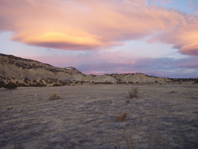
Yea, nice sunrise pic but note the atv track in the lower right corner.  This shot was taken from where I was camped.  They came by within inches in the middle of the night spewing rocks and hoots and hollers.  The episode lasted at least 2 hours...

Heading south from Escalante on the Smoky Mtn road takes a nice climb to the ride's high point.

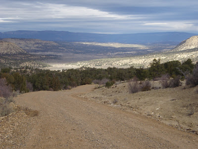
Beyond this point there is a wonderful section of rolling road.  It skirts several canyons, crosses others, big views abound.  You'll have to ride it to see it, I was too enthralled to stop ;)

I took a spur to the SW on Heads of the Canyons road.  It goes in and out of several drainages.  Plenty of up and down and road conditions similar to the Kokopelli trail.  I kept having deja vu...then I realized riding this was remarkably similar to the White Rim - except much less traveled, more tech and more climby.

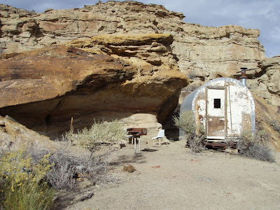
It drops through canyons on it's way to Big Water.  This looked old and abandoned but there was food in the cupboards - oops!

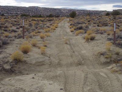
Everywhere to the north is wilderness study area - no motorized vehicles allowed.  Nice ATV tracks here, not one of them turning around at the signs.  What is about ATVs that requires disrespect for land and your fellow man plus mass stupidity to ride them?  My disgust is complete.

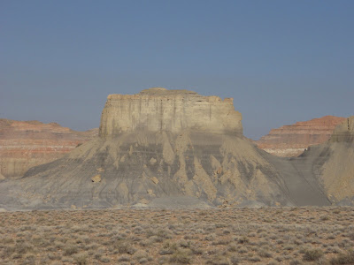
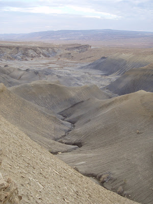
Strange black hearted canyons on the way into Big Water.

So there you have it.  This may be the off-season and all...and I think I'm chilling out but I've got quite the string of 25 hour weeks going here.  It's just too much fun to stop!

Published Monday, November 12, 2007 9:56 AM by Dave

Comments

# @ Monday, November 12, 2007 10:54 AM

Looks great. I gotta get down there one of these days. On the map, I have a route out of Escalante, on up to Salina. Once there you can take Skyline Drive all the way to Spanish Fork Canyon, and from there up into Park City, Utah Valley or Salt Lake City.

All it needs now is to be explored!


Adam L.

# @ Monday, November 12, 2007 11:17 AM

Very, very nice.

Jeff Kerkove

# @ Monday, November 12, 2007 12:26 PM

Wow ... what an amazing trip. Doesn't wilderness study area mean if the wilderness designation goes through, bicycles will no longer be allowed? I used to do a lot of advocating and volunteer work for the Southern Utah Wilderness Alliance. I can see myself having a harder time getting involved these days. Because while I love, respect and crave wilderness, I have a hard time justifying barring the law-abiding, low-impact cyclists from areas while reckless ATV'ers go right ahead and keep breaking the law, tearing up the land. BLM law enforcement is practically nonexsistant anyway. You said so yourself ... no sign of the man.

Either way, wow. So jealous. Your pictures are going to convince me I need to take a whirlwind, money-sucking winter trip to Utah, as Geoff did a few weeks ago.

Jill

# @ Monday, November 12, 2007 2:54 PM

Gah!

Because it's bad enough having to see it all vicariously, I want to make sure I don't miss out on that again. Soooo--here's my penance:

I WILL say YES when invited with Dave...


emc

# @ Monday, November 12, 2007 5:13 PM

Man that looks fun!

What no single ;)

SlowerThenSnot

# @ Monday, November 12, 2007 7:44 PM

Ummm....hate to be the bearer of bad news, but wilderness study area (WSA) also means no mechanized travel, so bike are banned as well. However, ask the average BLM enforcement officer and he doesn't even know that himself (my experience).

As for the drunken redneck in Utah - dude you are taking the wrong aporach. You live in friggin UTAH now - this is the state that sends officers out to bars to see if there are drunk people in bars! If people are drunk they shut the bar down. I say get your badge from the mormon coalition and flash it at the jonnhy yeahoos next time. ;-) Seriously though, your campfire probabaly made them think you were something they wanted to harass (most likely racially related).

As for the adventure...damn awesome to be out there in stuff like that this time of year. The SYDC looks alot like this, btw...just has fewer people and the only drunkards are the ranch hands who actually enjoy meeting you (and asking the inevitable question - why the fock are you out here?)

Matt

# @ Monday, November 12, 2007 8:38 PM

Our fire was well and dead out by then. We were both out by 830, to be woken hours later...

And I'm pretty positive that our route traced the boundary of the WSA in question, the cattlemen and gas drillers wouldn't let that (major) road be closed.

ionsmuse

# @ Monday, November 12, 2007 9:27 PM

Another feather in your adventurer's cap. Nice report.

Road conditions: 'unknown' - classic, and it sounds like the result couldn't have been better - adventure.

Nicely done, drunk rednecks aside. That pic with the ATV tracks looks like they ran right over you.

This is the kind of riding I live for.

Scott Morris

# @ Monday, November 12, 2007 9:59 PM

Matt - our route bordered many WSAs but never went into them. Not that we couldn't...BLM administered WSAs have a case by case set of travel restrictions. Some allow bikes, some don't. It really depends on if there's oil in them thar hills ;)

Dave

# @ Monday, November 12, 2007 11:23 PM

oh by the way...

ATV's=Texas Wheelchairs


=)

SlowerThenSnot